Vertical Italian Champioship
The route
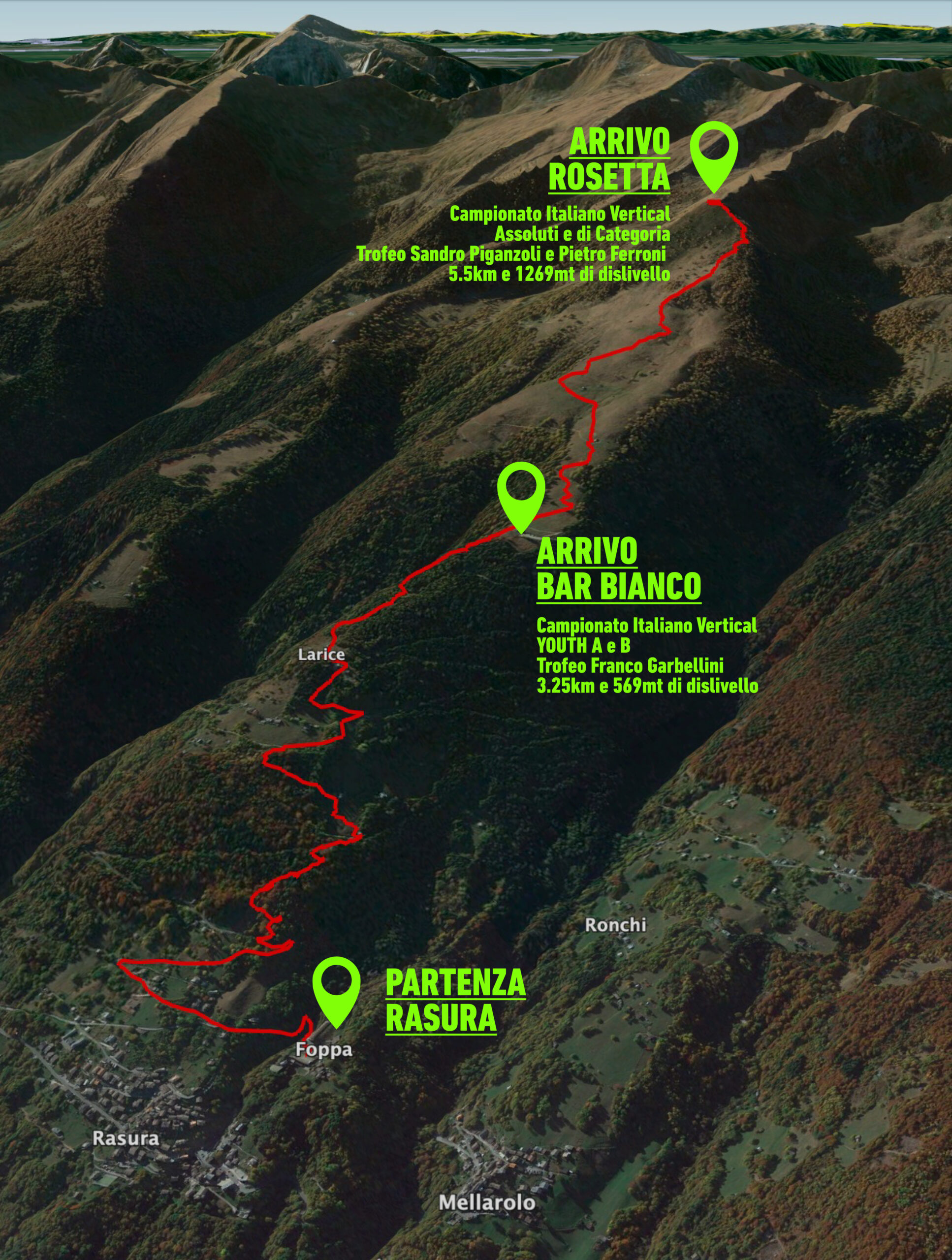
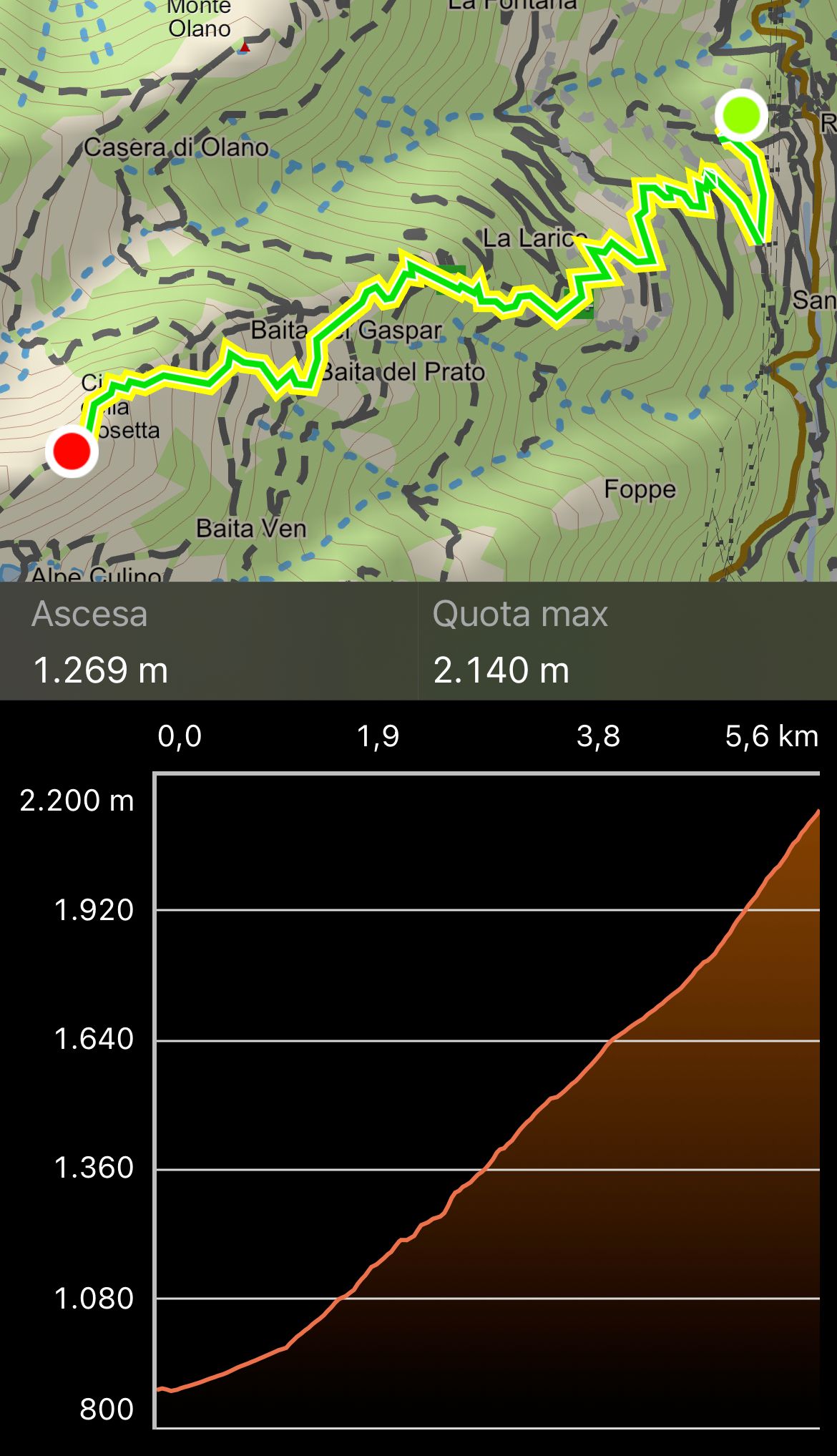
The starting point is the Polifunzionale of Rasura. The route covers 5.5 kilometres with a difference in altitude of 1,269 metres, almost entirely on footpath, within the frame of the Orobic mountains of Val Gerola, reaching the highest point at cima Rosetta, 2,150 metres (for the youth categories, the finish line is at the Bar Bianco refuge, 3.25 kilometres and 569 metres difference in altitude).
We urge all athletes to respect the unspoilt nature of the race route, so it is absolutely forbidden to litter the route.
Categories Youth A - Youth B
The route is 3.250 km with a positive development of 570 metres and runs through roads, mule tracks and forest paths, signposted with flags and by the presence of race control personnel.
Categories Under 23 - Senior - M40 - M45 - M50 - M55 - M60 - M65
The route is 5.500 km long with a positive development of 1270 metres and runs along roads, mule tracks, forest paths and high mountain paths through pastures with an easy final stretch on a ridge, signposted with flags and by the presence of race control personnel.
GPS track to download (in .gpx format):


